
Thank you for supporting this site ❤️
Make a donation
Make a donation
Gear up for your next adventure:
As an Amazon Associate, this site earns from qualifying purchases at no extra cost to you.
Dinara topographic map
Click on the map to display elevation.
Thank you for supporting this site ❤️
Make a donation
Make a donation
Gear up for your next adventure:
As an Amazon Associate, this site earns from qualifying purchases at no extra cost to you.
About this map
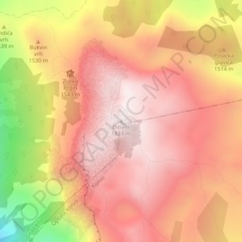
Name: Dinara topographic map, elevation, terrain.
Location: Dinara, Grad Knin, Šibenik-Knin County, Croatia (44.06243 16.38286 44.06253 16.38296)
Average elevation: 4,974 ft
Minimum elevation: 2,976 ft
Maximum elevation: 5,978 ft
Thank you for supporting this site ❤️
Make a donation
Make a donation
Gear up for your next adventure:
As an Amazon Associate, this site earns from qualifying purchases at no extra cost to you.