Geolocate

Cotulla topographic map

Click on the map to display elevation.

About this map

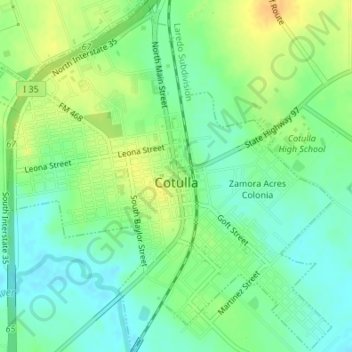
Name: Cotulla topographic map, elevation, terrain.

Location: Cotulla, La Salle County, Texas, United States (28.42146 -99.25282 28.45128 -99.21993)

Average elevation: 420 ft

Minimum elevation: 377 ft

Maximum elevation: 479 ft

La Salle County trails, hiking, mountain biking, running and outdoor activities

Gear up for your next adventure:

🧥Waterproof Jacket for Hiking - Breathable and rugged rain jacket for outdoor excursions
🥤Water Filter Bottle - All‑in‑one filter bottle for safe hydration
🥇GPS Hiking Watch - Multi‑sport GPS watch with navigation and trail tracking
🛌Ultralight Sleeping Bags - Compact down bags for cold nights in the wilderness
💧Water Filtration Bottles - Safely drink from streams and lakes while exploring

As an Amazon Associate, this site earns from qualifying purchases at no extra cost to you.