Geolocate

Collay Chico topographic map

Click on the map to display elevation.

👉 Easily get elevation data in JSON, GeoTIFF and KML formats using Elevation API
Thank you for supporting this site ❤️
Make a donation

About this map

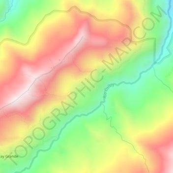
Name: Collay Chico topographic map, elevation, terrain.

Location: Collay Chico, San Vicente, El Pan, Azuay, Ecuador (-2.88139 -78.66526 -2.84139 -78.62526)

Average elevation: 9,639 ft

Minimum elevation: 8,186 ft

Maximum elevation: 11,024 ft

Gear up for your next adventure:

🧭Outdoor Navigation Book - Learn advanced navigation skills
🩹Survival Bandages - High‑quality bandages for emergencies
🥇GPS Hiking Watch - Multi‑sport GPS watch with navigation and trail tracking
Backpacking Tents - Weight-optimized shelters for multi-day topographic surveys
🧷Carabiner Set - Durable clips for gear attachment

As an Amazon Associate, this site earns from qualifying purchases at no extra cost to you.