
Thank you for supporting this site ❤️
Make a donation
Make a donation
Gear up for your next adventure:
As an Amazon Associate, this site earns from qualifying purchases at no extra cost to you.
Montegrosso topographic map
Click on the map to display elevation.
Thank you for supporting this site ❤️
Make a donation
Make a donation
Gear up for your next adventure:
As an Amazon Associate, this site earns from qualifying purchases at no extra cost to you.
About this map
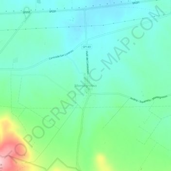
Name: Montegrosso topographic map, elevation, terrain.
Location: Montegrosso, Andria, Barletta-Andria-Trani, Puglia, Italia (41.15375 16.12013 41.19375 16.16013)
Average elevation: 764 ft
Minimum elevation: 594 ft
Maximum elevation: 1,293 ft
Thank you for supporting this site ❤️
Make a donation
Make a donation
Gear up for your next adventure:
As an Amazon Associate, this site earns from qualifying purchases at no extra cost to you.