Geolocate

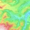
Le Cheix topographic map

Click on the map to display elevation.

About this map

Name: Le Cheix topographic map, elevation, terrain.

Location: Le Cheix, Saint-Diéry, Issoire, Puy-de-Dôme, Auvergne-Rhône-Alpes, France métropolitaine, 63320, France (45.52409 2.98042 45.56409 3.02042)

Average elevation: 2,539 ft

Minimum elevation: 1,998 ft

Maximum elevation: 3,399 ft

Other topographic maps

Click on a map to view its topography, its elevation and its terrain.
Gear up for your next adventure:

🔦Compact Flashlight - Reliable flashlight for emergencies
🗺️NatGeo Topo Maps - High-quality waterproof printed topographic maps of US Parks
🪶Camp Gear Gift Set - Perfect gift bundle for outdoor fans
🧣Merino Neck Gaiters - Multi-functional headwear for wind and sun protection
🚪Portable Camp Chair - Foldable chair for comfort at camp

As an Amazon Associate, this site earns from qualifying purchases at no extra cost to you.