
Thank you for supporting this site ❤️
Make a donation
Make a donation
Gear up for your next adventure:
As an Amazon Associate, this site earns from qualifying purchases at no extra cost to you.
Herlasgrün topographic map
Click on the map to display elevation.
Thank you for supporting this site ❤️
Make a donation
Make a donation
Gear up for your next adventure:
As an Amazon Associate, this site earns from qualifying purchases at no extra cost to you.
About this map
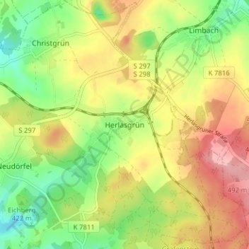
Name: Herlasgrün topographic map, elevation, terrain.
Location: Herlasgrün, Pöhl, Vogtlandkreis, Sachsen, 08543, Deutschland (50.54810 12.20995 50.58810 12.24995)
Average elevation: 1,411 ft
Minimum elevation: 1,198 ft
Maximum elevation: 1,640 ft
Thank you for supporting this site ❤️
Make a donation
Make a donation
Gear up for your next adventure:
As an Amazon Associate, this site earns from qualifying purchases at no extra cost to you.