
Thank you for supporting this site ❤️
Make a donation
Make a donation
Gear up for your next adventure:
As an Amazon Associate, this site earns from qualifying purchases at no extra cost to you.
Karukutty topographic map
Click on the map to display elevation.
Thank you for supporting this site ❤️
Make a donation
Make a donation
Gear up for your next adventure:
As an Amazon Associate, this site earns from qualifying purchases at no extra cost to you.
About this map
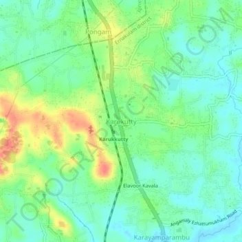
Name: Karukutty topographic map, elevation, terrain.
Location: Karukutty, Aluva, Ernakulam district, Kerala, 683576, India (10.20754 76.35502 10.24754 76.39502)
Average elevation: 75 ft
Minimum elevation: 7 ft
Maximum elevation: 197 ft
Thank you for supporting this site ❤️
Make a donation
Make a donation
Gear up for your next adventure:
As an Amazon Associate, this site earns from qualifying purchases at no extra cost to you.