
Thank you for supporting this site ❤️
Make a donation
Make a donation
Gear up for your next adventure:
As an Amazon Associate, this site earns from qualifying purchases at no extra cost to you.
Villabruna topographic map
Click on the map to display elevation.
Thank you for supporting this site ❤️
Make a donation
Make a donation
Gear up for your next adventure:
As an Amazon Associate, this site earns from qualifying purchases at no extra cost to you.
About this map
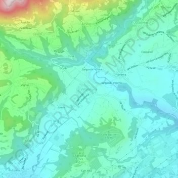
Name: Villabruna topographic map, elevation, terrain.
Location: Villabruna, Feltre, Belluno, Veneto, 32032, Italia (46.03979 11.91194 46.07979 11.95194)
Average elevation: 1,381 ft
Minimum elevation: 945 ft
Maximum elevation: 3,084 ft
Thank you for supporting this site ❤️
Make a donation
Make a donation
Gear up for your next adventure:
As an Amazon Associate, this site earns from qualifying purchases at no extra cost to you.