
Thank you for supporting this site ❤️
Make a donation
Make a donation
Gear up for your next adventure:
As an Amazon Associate, this site earns from qualifying purchases at no extra cost to you.
Ifucha topographic map
Click on the map to display elevation.
Thank you for supporting this site ❤️
Make a donation
Make a donation
Gear up for your next adventure:
As an Amazon Associate, this site earns from qualifying purchases at no extra cost to you.
About this map
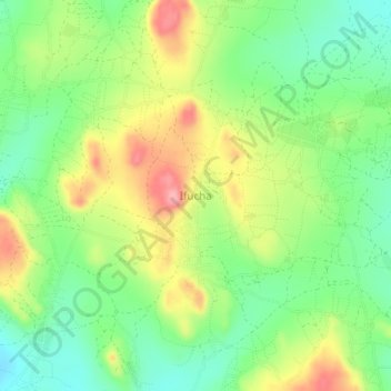
Name: Ifucha topographic map, elevation, terrain.
Location: Ifucha, Tabora Muncipal, Tabora Region, Central Zone, Tanzania (-5.05659 32.91505 -5.01659 32.95505)
Average elevation: 4,160 ft
Minimum elevation: 4,003 ft
Maximum elevation: 4,380 ft
Thank you for supporting this site ❤️
Make a donation
Make a donation
Gear up for your next adventure:
As an Amazon Associate, this site earns from qualifying purchases at no extra cost to you.
Other topographic maps
Click on a map to view its topography, its elevation and its terrain.