
Denizli topographic map
Click on the map to display elevation.
Denizli
Denizli is an industrial city in the southwestern part of Turkey and the eastern end of the alluvial valley formed by the river Büyük Menderes, where the plain reaches an elevation of about three hundred and fifty metres (1,148 ft). Denizli is located in the country's Aegean Region.
About this map
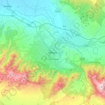
Name: Denizli topographic map, elevation, terrain.
Location: Denizli, Pamukkale, Denizli, Aegean Region, 20175, Turkey (37.62279 28.93665 37.94279 29.25665)
Average elevation: 2,438 ft
Minimum elevation: 459 ft
Maximum elevation: 8,274 ft
Other topographic maps
Click on a map to view its topography, its elevation and its terrain.