
Thank you for supporting this site ❤️
Make a donation
Make a donation
Gear up for your next adventure:
As an Amazon Associate, this site earns from qualifying purchases at no extra cost to you.
Vitello topographic map
Click on the map to display elevation.
Thank you for supporting this site ❤️
Make a donation
Make a donation
Gear up for your next adventure:
As an Amazon Associate, this site earns from qualifying purchases at no extra cost to you.
About this map
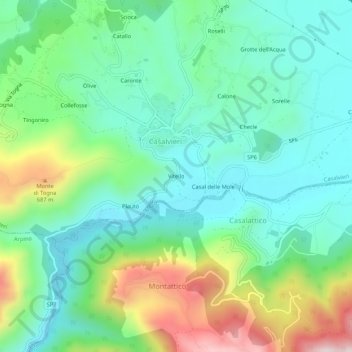
Name: Vitello topographic map, elevation, terrain.
Location: Vitello, Casalvieri, Frosinone, Lazio, 03034, Italia (41.60743 13.69465 41.64743 13.73465)
Average elevation: 1,460 ft
Minimum elevation: 889 ft
Maximum elevation: 2,848 ft
Thank you for supporting this site ❤️
Make a donation
Make a donation
Gear up for your next adventure:
As an Amazon Associate, this site earns from qualifying purchases at no extra cost to you.