
Thank you for supporting this site ❤️
Make a donation
Make a donation
Gear up for your next adventure:
As an Amazon Associate, this site earns from qualifying purchases at no extra cost to you.
Saclentz topographic map
Click on the map to display elevation.
Thank you for supporting this site ❤️
Make a donation
Make a donation
Gear up for your next adventure:
As an Amazon Associate, this site earns from qualifying purchases at no extra cost to you.
About this map
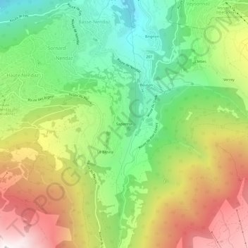
Name: Saclentz topographic map, elevation, terrain.
Location: Saclentz, Sornard, Nendaz, Gundis, Wallis, 1997, Schweiz (46.15605 7.29907 46.19605 7.33907)
Average elevation: 4,728 ft
Minimum elevation: 2,287 ft
Maximum elevation: 8,012 ft
Thank you for supporting this site ❤️
Make a donation
Make a donation
Gear up for your next adventure:
As an Amazon Associate, this site earns from qualifying purchases at no extra cost to you.