
Thank you for supporting this site ❤️
Make a donation
Make a donation
Gear up for your next adventure:
As an Amazon Associate, this site earns from qualifying purchases at no extra cost to you.
Keilir topographic map
Click on the map to display elevation.
Thank you for supporting this site ❤️
Make a donation
Make a donation
Gear up for your next adventure:
As an Amazon Associate, this site earns from qualifying purchases at no extra cost to you.
About this map
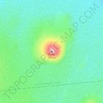
Name: Keilir topographic map, elevation, terrain.
Location: Keilir, Sveitarfélagið Vogar, Southern Peninsula, Iceland (63.94117 -22.17226 63.94127 -22.17216)
Average elevation: 584 ft
Minimum elevation: 413 ft
Maximum elevation: 1,217 ft
Thank you for supporting this site ❤️
Make a donation
Make a donation
Gear up for your next adventure:
As an Amazon Associate, this site earns from qualifying purchases at no extra cost to you.