
Thank you for supporting this site ❤️
Make a donation
Make a donation
Gear up for your next adventure:
As an Amazon Associate, this site earns from qualifying purchases at no extra cost to you.
dungahar topographic map
Click on the map to display elevation.
Thank you for supporting this site ❤️
Make a donation
Make a donation
Gear up for your next adventure:
As an Amazon Associate, this site earns from qualifying purchases at no extra cost to you.
About this map
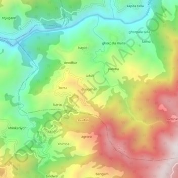
Name: dungahar topographic map, elevation, terrain.
Location: dungahar, Thailisain, Pauri Garhwal, Uttarakhand, India (29.78138 78.92621 29.82138 78.96621)
Average elevation: 4,757 ft
Minimum elevation: 3,133 ft
Maximum elevation: 6,903 ft
Thank you for supporting this site ❤️
Make a donation
Make a donation
Gear up for your next adventure:
As an Amazon Associate, this site earns from qualifying purchases at no extra cost to you.
Other topographic maps
Click on a map to view its topography, its elevation and its terrain.