
Thank you for supporting this site ❤️
Make a donation
Make a donation
Gear up for your next adventure:
As an Amazon Associate, this site earns from qualifying purchases at no extra cost to you.
jubal topographic map
Click on the map to display elevation.
Thank you for supporting this site ❤️
Make a donation
Make a donation
Gear up for your next adventure:
As an Amazon Associate, this site earns from qualifying purchases at no extra cost to you.
About this map
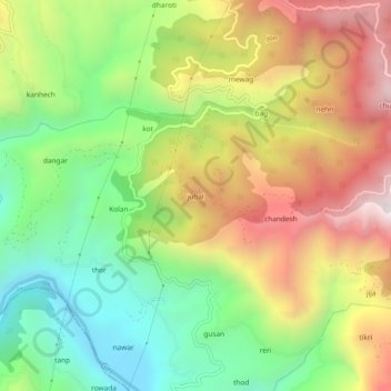
Name: jubal topographic map, elevation, terrain.
Location: jubal, Rajgarh, Sirmaur, Himachal Pradesh, 173101, India (30.79560 77.27238 30.83560 77.31238)
Average elevation: 4,275 ft
Minimum elevation: 2,625 ft
Maximum elevation: 6,335 ft
Thank you for supporting this site ❤️
Make a donation
Make a donation
Gear up for your next adventure:
As an Amazon Associate, this site earns from qualifying purchases at no extra cost to you.