
Thank you for supporting this site ❤️
Make a donation
Make a donation
Gear up for your next adventure:
As an Amazon Associate, this site earns from qualifying purchases at no extra cost to you.
Bogetići topographic map
Click on the map to display elevation.
Thank you for supporting this site ❤️
Make a donation
Make a donation
Gear up for your next adventure:
As an Amazon Associate, this site earns from qualifying purchases at no extra cost to you.
About this map
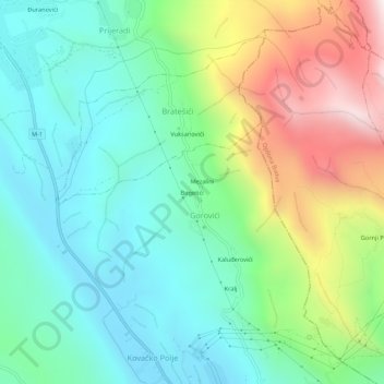
Name: Bogetići topographic map, elevation, terrain.
Location: Bogetići, Gorovići, Kotor Municipality, 85317, Montenegro (42.31734 18.77137 42.35734 18.81137)
Average elevation: 1,198 ft
Minimum elevation: 33 ft
Maximum elevation: 3,766 ft
Thank you for supporting this site ❤️
Make a donation
Make a donation
Gear up for your next adventure:
As an Amazon Associate, this site earns from qualifying purchases at no extra cost to you.