
Thank you for supporting this site ❤️
Make a donation
Make a donation
Gear up for your next adventure:
As an Amazon Associate, this site earns from qualifying purchases at no extra cost to you.
Hammedi topographic map
Click on the map to display elevation.
Thank you for supporting this site ❤️
Make a donation
Make a donation
Gear up for your next adventure:
As an Amazon Associate, this site earns from qualifying purchases at no extra cost to you.
About this map
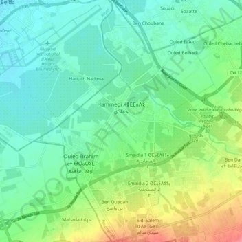
Name: Hammedi topographic map, elevation, terrain.
Location: Hammedi, Khemis El Khechna District, Boumerdès, Algeria (36.63572 3.22357 36.71562 3.29924)
Average elevation: 125 ft
Minimum elevation: 49 ft
Maximum elevation: 282 ft
Thank you for supporting this site ❤️
Make a donation
Make a donation
Gear up for your next adventure:
As an Amazon Associate, this site earns from qualifying purchases at no extra cost to you.