Geolocate

Staverton topographic map

Click on the map to display elevation.

About this map

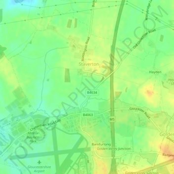
Name: Staverton topographic map, elevation, terrain.

Location: Staverton, Tewkesbury, Gloucestershire, South West England, England, United Kingdom (51.89222 -2.17780 51.91657 -2.13689)

Average elevation: 92 ft

Minimum elevation: 43 ft

Maximum elevation: 141 ft

Other topographic maps

Click on a map to view its topography, its elevation and its terrain.

Gear up for your next adventure:

🥾Hiking Shoes - Durable and comfortable shoes for trail hiking
Backpacking Tents - Weight-optimized shelters for multi-day topographic surveys
📶Satellite Messenger - Communication device off‑grid
🎒Hydration Pack - Hands‑free water reservoir for long hikes
📱Heavy-Duty Phone Cases - Drop-proof and waterproof protection for outdoor navigation

As an Amazon Associate, this site earns from qualifying purchases at no extra cost to you.