
Thank you for supporting this site ❤️
Make a donation
Make a donation
Gear up for your next adventure:
As an Amazon Associate, this site earns from qualifying purchases at no extra cost to you.
Botijas topographic map
Click on the map to display elevation.
Thank you for supporting this site ❤️
Make a donation
Make a donation
Gear up for your next adventure:
As an Amazon Associate, this site earns from qualifying purchases at no extra cost to you.
About this map
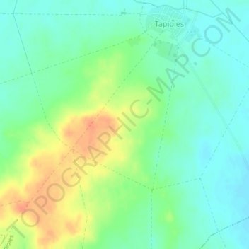
Name: Botijas topographic map, elevation, terrain.
Location: Botijas, Tapioles, Zamora, Castile and León, 49129, Spain (41.83603 -5.51268 41.85603 -5.49268)
Average elevation: 2,287 ft
Minimum elevation: 2,234 ft
Maximum elevation: 2,369 ft
Thank you for supporting this site ❤️
Make a donation
Make a donation
Gear up for your next adventure:
As an Amazon Associate, this site earns from qualifying purchases at no extra cost to you.