
Thank you for supporting this site ❤️
Make a donation
Make a donation
Gear up for your next adventure:
As an Amazon Associate, this site earns from qualifying purchases at no extra cost to you.
Thakhek topographic map
Click on the map to display elevation.
Thank you for supporting this site ❤️
Make a donation
Make a donation
Gear up for your next adventure:
As an Amazon Associate, this site earns from qualifying purchases at no extra cost to you.
About this map
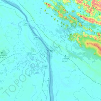
Name: Thakhek topographic map, elevation, terrain.
Location: Thakhek, Thakhek District, Khammouane, 12000, Laos (17.23462 104.64645 17.55462 104.96645)
Average elevation: 587 ft
Minimum elevation: 436 ft
Maximum elevation: 2,556 ft
Thank you for supporting this site ❤️
Make a donation
Make a donation
Gear up for your next adventure:
As an Amazon Associate, this site earns from qualifying purchases at no extra cost to you.