
Thank you for supporting this site ❤️
Make a donation
Make a donation
Gear up for your next adventure:
As an Amazon Associate, this site earns from qualifying purchases at no extra cost to you.
Ahwa topographic map
Click on the map to display elevation.
Thank you for supporting this site ❤️
Make a donation
Make a donation
Gear up for your next adventure:
As an Amazon Associate, this site earns from qualifying purchases at no extra cost to you.
About this map
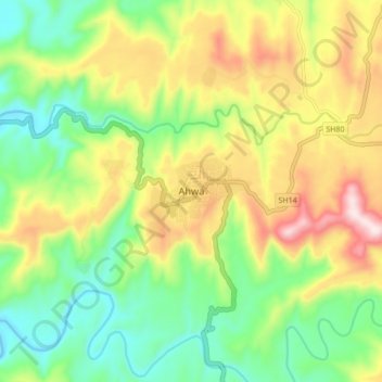
Name: Ahwa topographic map, elevation, terrain.
Location: Ahwa, Ahava Taluka, Dang, Gujarat, 394710, India (20.71873 73.64735 20.79873 73.72735)
Average elevation: 1,289 ft
Minimum elevation: 709 ft
Maximum elevation: 2,149 ft
Thank you for supporting this site ❤️
Make a donation
Make a donation
Gear up for your next adventure:
As an Amazon Associate, this site earns from qualifying purchases at no extra cost to you.