
Thank you for supporting this site ❤️
Make a donation
Make a donation
Gear up for your next adventure:
As an Amazon Associate, this site earns from qualifying purchases at no extra cost to you.
Safsaf topographic map
Click on the map to display elevation.
Thank you for supporting this site ❤️
Make a donation
Make a donation
Gear up for your next adventure:
As an Amazon Associate, this site earns from qualifying purchases at no extra cost to you.
About this map
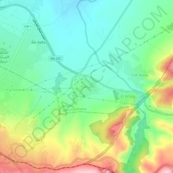
Name: Safsaf topographic map, elevation, terrain.
Location: Safsaf, Chetouane, Daïra Chetouane, Tlemcen, 13048, Algérie (34.87995 -1.29596 34.91995 -1.25596)
Average elevation: 2,146 ft
Minimum elevation: 1,831 ft
Maximum elevation: 2,766 ft
Thank you for supporting this site ❤️
Make a donation
Make a donation
Gear up for your next adventure:
As an Amazon Associate, this site earns from qualifying purchases at no extra cost to you.