Geolocate

Shawano topographic map

Click on the map to display elevation.

About this map

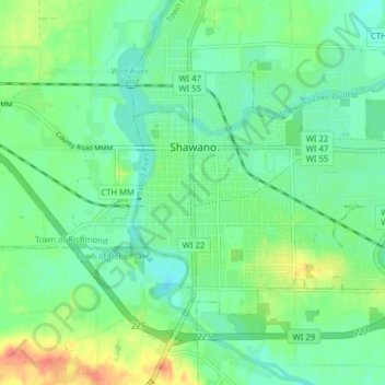
Name: Shawano topographic map, elevation, terrain.

Location: Shawano, Shawano County, Wisconsin, United States (44.75788 -88.62125 44.79312 -88.54246)

Average elevation: 830 ft

Minimum elevation: 778 ft

Maximum elevation: 942 ft

Shawano County trails, hiking, mountain biking, running and outdoor activities

Gear up for your next adventure:

🪶Wildlife Field Guides - Learn animal tracking and species ID
🔦Powerful Headlamps - Ultra-bright hands-free lighting for night navigation
🎒Trail Energy Bars - High‑calorie bars for hiking energy
🔭Stargazing Telescopes - Perfect for camping in low-light pollution areas shown on maps
😴Insulated Sleeping Pads - Compact and warm pads for high-elevation camping

As an Amazon Associate, this site earns from qualifying purchases at no extra cost to you.