Geolocate

Morebath topographic map

Click on the map to display elevation.

About this map

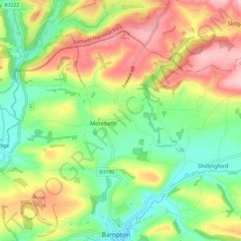
Name: Morebath topographic map, elevation, terrain.

Location: Morebath, Mid Devon, Devon, England, United Kingdom (50.99617 -3.52732 51.03384 -3.44624)

Average elevation: 594 ft

Minimum elevation: 325 ft

Maximum elevation: 955 ft

Gear up for your next adventure:

🌲Outdoor Survival Books - Best books on survival skills
🥄Camping Utensil Set - Lightweight utensils for outdoor meals
🧭Pro Hiking Compasses - High-accuracy liquid-filled compasses for topographic orientation
🛏️Cold Weather Sleeping Bag - Warm sleeping bag for cold conditions
📶Vehicle Signal Boosters - Improve reception in rural areas while driving to trailheads

As an Amazon Associate, this site earns from qualifying purchases at no extra cost to you.