
Flamstead topographic map
Click on the map to display elevation.
About this map
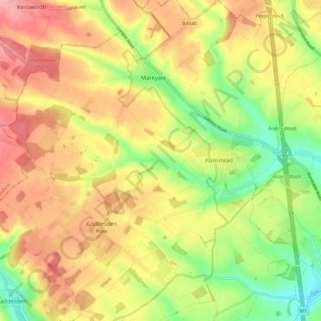
Name: Flamstead topographic map, elevation, terrain.
Location: Flamstead, Dacorum, Hertfordshire, England, United Kingdom (51.78777 -0.51122 51.85021 -0.40488)
Average elevation: 486 ft
Minimum elevation: 315 ft
Maximum elevation: 630 ft
Other topographic maps
Click on a map to view its topography, its elevation and its terrain.
Trowley Bottom
United Kingdom > England > Hertfordshire > Dacorum > Flamstead
Average elevation: 456 ft