
Thank you for supporting this site ❤️
Make a donation
Make a donation
Gear up for your next adventure:
As an Amazon Associate, this site earns from qualifying purchases at no extra cost to you.
Montespluga topographic map
Click on the map to display elevation.
Thank you for supporting this site ❤️
Make a donation
Make a donation
Gear up for your next adventure:
As an Amazon Associate, this site earns from qualifying purchases at no extra cost to you.
About this map
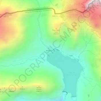
Name: Montespluga topographic map, elevation, terrain.
Average elevation: 7,198 ft
Minimum elevation: 5,735 ft
Maximum elevation: 9,833 ft
Thank you for supporting this site ❤️
Make a donation
Make a donation
Gear up for your next adventure:
As an Amazon Associate, this site earns from qualifying purchases at no extra cost to you.
Other topographic maps
Click on a map to view its topography, its elevation and its terrain.
Lago di Emet
Italia > Lombardia > Sondrio > Madesimo
Il lago Emet è un laghetto alpino situato, ad un'altitudine di 2.145 metri, nel comune di Madesimo (SO) in alta Valle Spluga.
Average elevation: 7,326 ft