
Thank you for supporting this site ❤️
Make a donation
Make a donation
Gear up for your next adventure:
As an Amazon Associate, this site earns from qualifying purchases at no extra cost to you.
Trivigno topographic map
Click on the map to display elevation.
Thank you for supporting this site ❤️
Make a donation
Make a donation
Gear up for your next adventure:
As an Amazon Associate, this site earns from qualifying purchases at no extra cost to you.
About this map
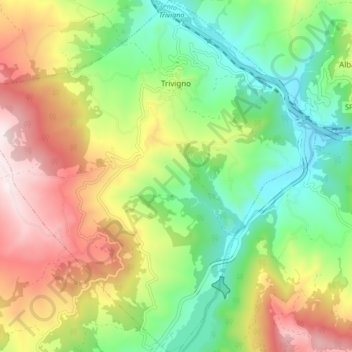
Name: Trivigno topographic map, elevation, terrain.
Location: Trivigno, Potenza, Basilicata, 85018, Italia (40.53220 15.94019 40.59601 16.02359)
Average elevation: 2,382 ft
Minimum elevation: 1,430 ft
Maximum elevation: 3,750 ft
Thank you for supporting this site ❤️
Make a donation
Make a donation
Gear up for your next adventure:
As an Amazon Associate, this site earns from qualifying purchases at no extra cost to you.