
Thank you for supporting this site ❤️
Make a donation
Make a donation
Gear up for your next adventure:
As an Amazon Associate, this site earns from qualifying purchases at no extra cost to you.
Ly topographic map
Click on the map to display elevation.
Thank you for supporting this site ❤️
Make a donation
Make a donation
Gear up for your next adventure:
As an Amazon Associate, this site earns from qualifying purchases at no extra cost to you.
About this map
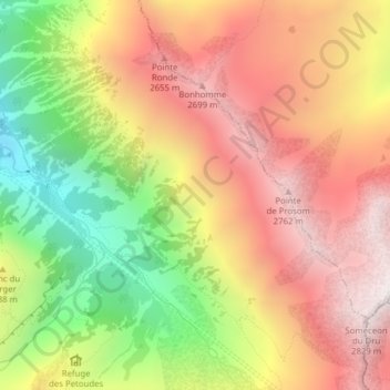
Name: Ly topographic map, elevation, terrain.
Location: Ly, Trient, Martigny, Wallis, 1929, Switzerland (46.02146 7.01306 46.04146 7.03306)
Average elevation: 7,329 ft
Minimum elevation: 4,911 ft
Maximum elevation: 9,288 ft
Thank you for supporting this site ❤️
Make a donation
Make a donation
Gear up for your next adventure:
As an Amazon Associate, this site earns from qualifying purchases at no extra cost to you.