
Make a donation
Gear up for your next adventure:
As an Amazon Associate, this site earns from qualifying purchases at no extra cost to you.
Rio topographic map
Click on the map to display elevation.
Make a donation
Gear up for your next adventure:
As an Amazon Associate, this site earns from qualifying purchases at no extra cost to you.
About this map
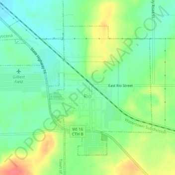
Name: Rio topographic map, elevation, terrain.
Location: Rio, Columbia County, Wisconsin, United States (43.43864 -89.25971 43.45951 -89.22619)
Average elevation: 955 ft
Minimum elevation: 876 ft
Maximum elevation: 1,089 ft
Columbia County trails, hiking, mountain biking, running and outdoor activities
Make a donation
Gear up for your next adventure:
As an Amazon Associate, this site earns from qualifying purchases at no extra cost to you.
Other topographic maps
Click on a map to view its topography, its elevation and its terrain.
Englewood
United States > Wisconsin > Columbia County > Town of Fountain Prairie
Average elevation: 906 ft