
Thank you for supporting this site ❤️
Make a donation
Make a donation
Gear up for your next adventure:
As an Amazon Associate, this site earns from qualifying purchases at no extra cost to you.
Anandpur topographic map
Click on the map to display elevation.
Thank you for supporting this site ❤️
Make a donation
Make a donation
Gear up for your next adventure:
As an Amazon Associate, this site earns from qualifying purchases at no extra cost to you.
About this map
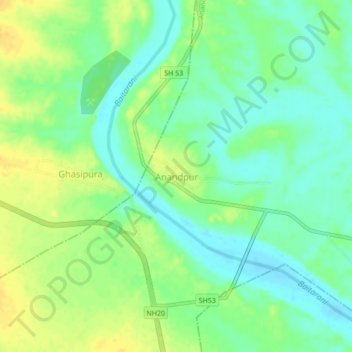
Name: Anandpur topographic map, elevation, terrain.
Location: Anandpur, Anandapur, Kendujhar, Odisha, 756046, India (21.19435 86.10319 21.23435 86.14319)
Average elevation: 141 ft
Minimum elevation: 102 ft
Maximum elevation: 184 ft
Thank you for supporting this site ❤️
Make a donation
Make a donation
Gear up for your next adventure:
As an Amazon Associate, this site earns from qualifying purchases at no extra cost to you.