
Asker topographic map
Click on the map to display elevation.
About this map
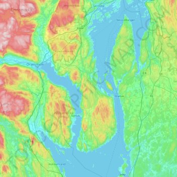
Name: Asker topographic map, elevation, terrain.
Location: Asker, Akershus, Norway (59.45733 10.29006 59.90594 10.63499)
Average elevation: 430 ft
Minimum elevation: -13 ft
Maximum elevation: 1,959 ft
Other topographic maps
Click on a map to view its topography, its elevation and its terrain.