Geolocate

Kasaragod topographic map

Click on the map to display elevation.

About this map

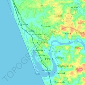
Name: Kasaragod topographic map, elevation, terrain.

Location: Kasaragod, Kasaragod District, Kerala, 671121, India (12.46356 74.95070 12.54356 75.03070)

Average elevation: 62 ft

Minimum elevation: -10 ft

Maximum elevation: 292 ft

Gear up for your next adventure:

📶Vehicle Signal Boosters - Improve reception in rural areas while driving to trailheads
🌡️Portable Weather Meter - Track weather conditions on the trail
🪄Magnetic Compass - Accurate compass for navigation
📚USA Hiking Guide Books - Top trail guides and map books
🔭Stargazing Telescopes - Perfect for camping in low-light pollution areas shown on maps

As an Amazon Associate, this site earns from qualifying purchases at no extra cost to you.