
Thank you for supporting this site ❤️
Make a donation
Make a donation
Gear up for your next adventure:
As an Amazon Associate, this site earns from qualifying purchases at no extra cost to you.
Kastanienbaum topographic map
Click on the map to display elevation.
Thank you for supporting this site ❤️
Make a donation
Make a donation
Gear up for your next adventure:
As an Amazon Associate, this site earns from qualifying purchases at no extra cost to you.
About this map
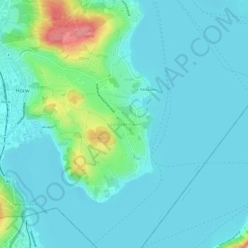
Name: Kastanienbaum topographic map, elevation, terrain.
Location: Kastanienbaum, Horw, Luzern, 6047, Schweiz (46.99308 8.31487 47.03308 8.35487)
Average elevation: 1,499 ft
Minimum elevation: 1,394 ft
Maximum elevation: 2,021 ft
Thank you for supporting this site ❤️
Make a donation
Make a donation
Gear up for your next adventure:
As an Amazon Associate, this site earns from qualifying purchases at no extra cost to you.