
Windsor topographic map
Interactive map
Click on the map to display elevation.
About this map
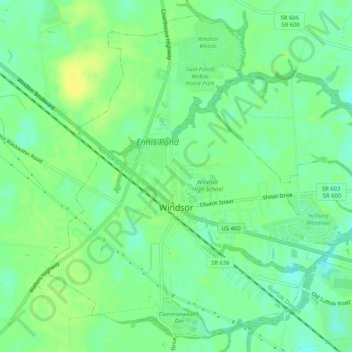
Name: Windsor topographic map, elevation, terrain.
Location: Windsor, Isle of Wight County, Virginia, United States (36.79315 -76.76356 36.83114 -76.71173)
Average elevation: 85 ft
Minimum elevation: 52 ft
Maximum elevation: 115 ft
Other topographic maps
Click on a map to view its topography, its elevation and its terrain.
Carrsville
United States > Virginia > Isle of Wight County
Carrsville, Isle of Wight County, Virginia, 23315, United States
Average elevation: 69 ft
Whitley
United States > Virginia > Isle of Wight County
Whitley, Isle of Wight County, Virginia, United States
Average elevation: 79 ft
Smithfield
United States > Virginia > Isle of Wight County
Smithfield, Isle of Wight County, Virginia, 23430, United States
Average elevation: 36 ft
Smithfield
United States > Virginia > Isle of Wight County > Smithfield
Smithfield, Isle of Wight County, Virginia, 23430, United States
Average elevation: 36 ft