
Whitley topographic map
Click on the map to display elevation.
About this map
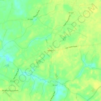
Name: Whitley topographic map, elevation, terrain.
Location: Whitley, Isle of Wight County, Virginia, United States (36.86543 -76.77940 36.90543 -76.73940)
Average elevation: 79 ft
Minimum elevation: 39 ft
Maximum elevation: 102 ft
Isle of Wight County trails, hiking, mountain biking, running and outdoor activities
Other topographic maps
Click on a map to view its topography, its elevation and its terrain.