Geolocate

Machern topographic map

Click on the map to display elevation.

About this map
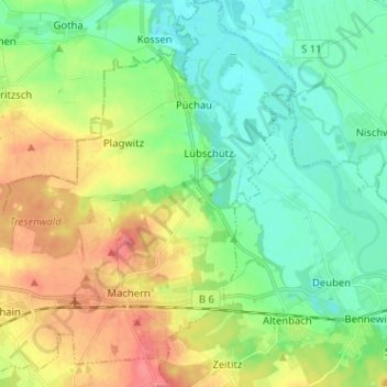
Name: Machern topographic map, elevation, terrain.

Location: Machern, Landkreis Leipzig, Saxônia, 04827, Alemanha (51.34118 12.55913 51.42070 12.68443)

Average elevation: 420 ft

Minimum elevation: 338 ft

Maximum elevation: 564 ft

Gear up for your next adventure:

🧺Microfiber Travel Towels - Compact and fast-drying towels for trail use
🪶Camp Gear Gift Set - Perfect gift bundle for outdoor fans
🥾Hiking Shoes - Durable and comfortable shoes for trail hiking
🥩Freeze-Dried Meals - Nutritious and lightweight food for remote expeditions
🏕️Family Camping Gear - Essentials for group camping trips

As an Amazon Associate, this site earns from qualifying purchases at no extra cost to you.