Geolocate

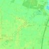
Dohren topographic map

Click on the map to display elevation.

About this map

Name: Dohren topographic map, elevation, terrain.

Location: Dohren, Samtgemeinde Herzlake, Landkreis Emsland, Nedersaksen, Duitsland (52.60951 7.54267 52.65832 7.65815)

Average elevation: 75 ft

Minimum elevation: 52 ft

Maximum elevation: 128 ft

Other topographic maps

Click on a map to view its topography, its elevation and its terrain.
Sustrum-Moor

Duitsland > Nedersaksen > Landkreis Emsland

Average elevation: 36 ft

Gleesen

Duitsland > Nedersaksen > Landkreis Emsland

Average elevation: 95 ft

Neusustrum

Duitsland > Nedersaksen > Landkreis Emsland

Average elevation: 36 ft

Hesselte

Duitsland > Nedersaksen > Landkreis Emsland > Emsbüren

Average elevation: 102 ft

Baccum

Duitsland > Nedersaksen > Landkreis Emsland > Lingen (Ems)

Average elevation: 138 ft

Ramsel

Duitsland > Nedersaksen > Landkreis Emsland > Lingen (Ems)

Average elevation: 128 ft

Sprakel

Duitsland > Nedersaksen > Landkreis Emsland > Stavern

Average elevation: 128 ft

Sand

Duitsland > Nedersaksen > Landkreis Emsland > Oberlangen

Average elevation: 33 ft

Haar

Duitsland > Nedersaksen > Landkreis Emsland > Haren (Ems)

Average elevation: 49 ft

Gear up for your next adventure:

🥩Freeze-Dried Meals - Nutritious and lightweight food for remote expeditions
🌄Hiking Binoculars - Compact binoculars for scenic views and trail spotting
🎒Trail Energy Bars - High‑calorie bars for hiking energy
📚Navigation Handbooks - Master the art of reading topographic maps and using a compass
🦶Carbon Trekking Poles - Reduce knee impact on steep descents with ultra-light poles

As an Amazon Associate, this site earns from qualifying purchases at no extra cost to you.