
Thank you for supporting this site ❤️
Make a donation
Make a donation
Gear up for your next adventure:
As an Amazon Associate, this site earns from qualifying purchases at no extra cost to you.
Pereirinha topographic map
Click on the map to display elevation.
Thank you for supporting this site ❤️
Make a donation
Make a donation
Gear up for your next adventure:
As an Amazon Associate, this site earns from qualifying purchases at no extra cost to you.
About this map
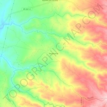
Name: Pereirinha topographic map, elevation, terrain.
Location: Pereirinha, Melides, Grândola, Setúbal, 7570-486, Portugal (38.12076 -8.71119 38.16076 -8.67119)
Average elevation: 486 ft
Minimum elevation: 115 ft
Maximum elevation: 866 ft
Thank you for supporting this site ❤️
Make a donation
Make a donation
Gear up for your next adventure:
As an Amazon Associate, this site earns from qualifying purchases at no extra cost to you.