Geolocate

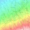
Tambo topographic map

Click on the map to display elevation.

About this map

Name: Tambo topographic map, elevation, terrain.

Location: Tambo, Buhi, Camarines Sur, Bicol Region, 4433, Philippines (13.44937 123.47217 13.48937 123.51217)

Average elevation: 584 ft

Minimum elevation: 249 ft

Maximum elevation: 1,985 ft

Other topographic maps

Click on a map to view its topography, its elevation and its terrain.
Lake Buhi

Philippines > Camarines Sur > Buhi

Average elevation: 351 ft

Gear up for your next adventure:

🦺Reflective Outdoor Gear - Safety gear for low‑light conditions
🛡️Insect Repellent - Protection against bugs during outdoor activities
🥾Men's Hiking Boots - Durable, waterproof footwear for rugged terrain and steep inclines
🛠️Backpacking Tool Kit - Essential toolkit for outdoor repairs
🌡️Portable Weather Meter - Track weather conditions on the trail

As an Amazon Associate, this site earns from qualifying purchases at no extra cost to you.