
Celica topographic map
Click on the map to display elevation.
Celica
Celica is a canton in Loja Province, Ecuador. Its seat is Celica. The canton is located in the west of the province and is bordered by the cantons of Puyango and Paltas in the north, Sozoranga in the east, Macará in the south, and Pindal and Zapotillo in the west. It covers 521.9 km2 at an altitude of 2,500 m.
About this map
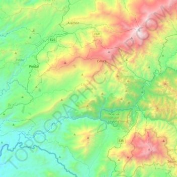
Name: Celica topographic map, elevation, terrain.
Location: Celica, Loja, 110401, Ecuador (-4.27717 -80.24102 -4.05255 -79.84508)
Average elevation: 3,570 ft
Minimum elevation: 656 ft
Maximum elevation: 10,072 ft
Other topographic maps
Click on a map to view its topography, its elevation and its terrain.