Geolocate

Cosina topographic map

Click on the map to display elevation.

About this map

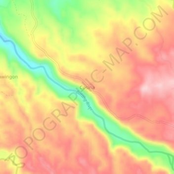
Name: Cosina topographic map, elevation, terrain.

Location: Cosina, Talakag, Bukidnon, Northern Mindanao, Philippines (8.08467 124.60042 8.12467 124.64042)

Average elevation: 2,192 ft

Minimum elevation: 1,742 ft

Maximum elevation: 2,480 ft

Gear up for your next adventure:

🌎3D Topographic Globes - Raised relief globes for a tactile understanding of geography
🧯Portable Fire Pit - Compact fire pit for camping spots
🦟Ultrasonic Repellers - Create a bug-free zone at your camp or rest stop
🥘Titanium Cookware - Durable, featherlight pots and pans for backpacking
🧼Biodegradable Camping Soap - Eco‑friendly soap for outdoor hygiene

As an Amazon Associate, this site earns from qualifying purchases at no extra cost to you.