
Thank you for supporting this site ❤️
Make a donation
Make a donation
Gear up for your next adventure:
As an Amazon Associate, this site earns from qualifying purchases at no extra cost to you.
Volterrano topographic map
Click on the map to display elevation.
Thank you for supporting this site ❤️
Make a donation
Make a donation
Gear up for your next adventure:
As an Amazon Associate, this site earns from qualifying purchases at no extra cost to you.
About this map
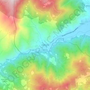
Name: Volterrano topographic map, elevation, terrain.
Location: Volterrano, Città di Castello, Perugia, Umbria, Italia (43.34919 12.07189 43.38919 12.11189)
Average elevation: 1,745 ft
Minimum elevation: 948 ft
Maximum elevation: 2,999 ft
Thank you for supporting this site ❤️
Make a donation
Make a donation
Gear up for your next adventure:
As an Amazon Associate, this site earns from qualifying purchases at no extra cost to you.