Geolocate

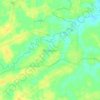
sumberejo topographic map

Click on the map to display elevation.

About this map
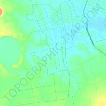
Name: sumberejo topographic map, elevation, terrain.

Location: sumberejo, Lampung Timur, Lampung, Sumatra, Indonesia (-5.22891 105.66485 -5.17692 105.71429)

Average elevation: 115 ft

Minimum elevation: 13 ft

Maximum elevation: 420 ft

Other topographic maps

Click on a map to view its topography, its elevation and its terrain.
Mataram Baru

Indonesia > Lampung > Lampung Timur

Average elevation: 92 ft

Pekalongan

Indonesia > Lampung > Lampung Timur

Average elevation: 135 ft

Raja Basa Lama

Indonesia > Lampung > Lampung Timur

Average elevation: 95 ft

Jojog

Indonesia > Lampung > Lampung Timur

Average elevation: 108 ft

Kibang

Indonesia > Lampung > Lampung Timur

Average elevation: 167 ft

Labuhan Maringgai

Indonesia > Lampung > Lampung Timur

Average elevation: 89 ft

Labuhan Ratu Satu

Indonesia > Lampung > Lampung Timur

Average elevation: 52 ft

Pelindung Jaya

Indonesia > Lampung > Lampung Timur

Average elevation: 141 ft

Negara Ratu

Indonesia > Lampung > Lampung Timur

Average elevation: 108 ft

Braja Asri

Indonesia > Lampung > Lampung Timur

Average elevation: 56 ft

Negara Batin

Indonesia > Lampung > Lampung Timur

Average elevation: 171 ft

Negeri Agung

Indonesia > Lampung > Lampung Timur

Average elevation: 151 ft

Negeri Katon

Indonesia > Lampung > Lampung Timur

Average elevation: 335 ft

Ngesti Karya

Indonesia > Lampung > Lampung Timur

Average elevation: 115 ft

Sukadana

Indonesia > Lampung > Lampung Timur

Average elevation: 92 ft

Gear up for your next adventure:

⌚Solar GPS Watches - Advanced multisport watches with built-in topographic maps
🔊Portable Camp Speaker - Music and alerts at camp
🛠️Backpacking Tool Kit - Essential toolkit for outdoor repairs
📱Solar Portable Charger - Solar power bank for charging devices off‑grid
🥘Titanium Cookware - Durable, featherlight pots and pans for backpacking

As an Amazon Associate, this site earns from qualifying purchases at no extra cost to you.