
Thank you for supporting this site ❤️
Make a donation
Make a donation
Gear up for your next adventure:
As an Amazon Associate, this site earns from qualifying purchases at no extra cost to you.
Huaycho topographic map
Click on the map to display elevation.
Thank you for supporting this site ❤️
Make a donation
Make a donation
Gear up for your next adventure:
As an Amazon Associate, this site earns from qualifying purchases at no extra cost to you.
About this map
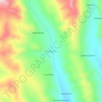
Name: Huaycho topographic map, elevation, terrain.
Location: Huaycho, Nuñoa, Melgar, Puno, Perú (-14.26316 -70.60915 -14.22316 -70.56915)
Average elevation: 15,184 ft
Minimum elevation: 14,472 ft
Maximum elevation: 16,296 ft
Thank you for supporting this site ❤️
Make a donation
Make a donation
Gear up for your next adventure:
As an Amazon Associate, this site earns from qualifying purchases at no extra cost to you.