
Tsavo East National Park topographic map
Interactive map
Click on the map to display elevation.
About this map
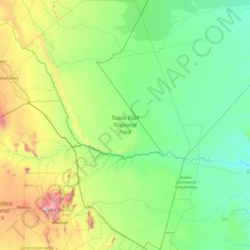
Name: Tsavo East National Park topographic map, elevation, terrain.
Location: Tsavo East National Park, Eastern, Kenya (-3.68679 38.13524 -1.99659 39.26355)
Average elevation: 1,476 ft
Minimum elevation: 243 ft
Maximum elevation: 7,146 ft