Geolocate

Manley topographic map

Click on the map to display elevation.

About this map

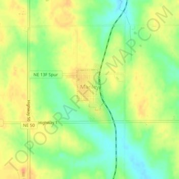
Name: Manley topographic map, elevation, terrain.

Location: Manley, Cass County, Nebraska, 68403, United States (40.91611 -96.16864 40.92221 -96.16303)

Average elevation: 1,270 ft

Minimum elevation: 1,201 ft

Maximum elevation: 1,329 ft

Cass County trails, hiking, mountain biking, running and outdoor activities

Gear up for your next adventure:

🌡️Handheld Weather Meters - Measure wind, temp, and pressure for safe mountain travel
📦Gear Storage Bags - Organize and protect outdoor equipment
🦶Carbon Trekking Poles - Reduce knee impact on steep descents with ultra-light poles
📶Satellite Messenger - Communication device off‑grid
🧢Sun Protection Hats - Wide-brimmed and UPF-rated hats for high-altitude sun safety

As an Amazon Associate, this site earns from qualifying purchases at no extra cost to you.