
Thank you for supporting this site ❤️
Make a donation
Make a donation
Gear up for your next adventure:
As an Amazon Associate, this site earns from qualifying purchases at no extra cost to you.
Tlatlauquitepec topographic map
Click on the map to display elevation.
Thank you for supporting this site ❤️
Make a donation
Make a donation
Gear up for your next adventure:
As an Amazon Associate, this site earns from qualifying purchases at no extra cost to you.
About this map
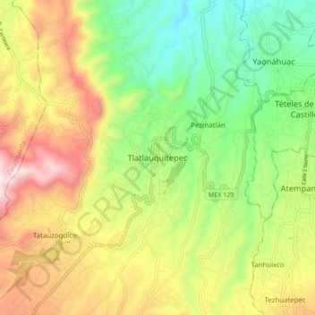
Name: Tlatlauquitepec topographic map, elevation, terrain.
Location: Tlatlauquitepec, Puebla, 73900, México (19.80776 -97.53701 19.88776 -97.45701)
Average elevation: 6,437 ft
Minimum elevation: 5,236 ft
Maximum elevation: 8,041 ft
Thank you for supporting this site ❤️
Make a donation
Make a donation
Gear up for your next adventure:
As an Amazon Associate, this site earns from qualifying purchases at no extra cost to you.