
Thank you for supporting this site ❤️
Make a donation
Make a donation
Gear up for your next adventure:
As an Amazon Associate, this site earns from qualifying purchases at no extra cost to you.
Ban Klang topographic map
Click on the map to display elevation.
Thank you for supporting this site ❤️
Make a donation
Make a donation
Gear up for your next adventure:
As an Amazon Associate, this site earns from qualifying purchases at no extra cost to you.
About this map
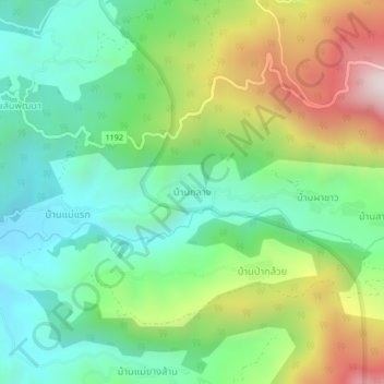
Name: Ban Klang topographic map, elevation, terrain.
Location: Ban Klang, Tha Pha, Mae Chaem, Chiang Mai Province, Thailand (18.48390 98.42431 18.52390 98.46431)
Average elevation: 2,949 ft
Minimum elevation: 1,932 ft
Maximum elevation: 4,902 ft
Thank you for supporting this site ❤️
Make a donation
Make a donation
Gear up for your next adventure:
As an Amazon Associate, this site earns from qualifying purchases at no extra cost to you.