
Thank you for supporting this site ❤️
Make a donation
Make a donation
Gear up for your next adventure:
As an Amazon Associate, this site earns from qualifying purchases at no extra cost to you.
Pavones topographic map
Click on the map to display elevation.
Thank you for supporting this site ❤️
Make a donation
Make a donation
Gear up for your next adventure:
As an Amazon Associate, this site earns from qualifying purchases at no extra cost to you.
About this map
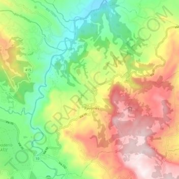
Name: Pavones topographic map, elevation, terrain.
Location: Pavones, Turrialba, Cartago Province, 30506, Costa Rica (9.87085 -83.65197 9.95845 -83.57491)
Average elevation: 2,484 ft
Minimum elevation: 1,204 ft
Maximum elevation: 4,137 ft
Thank you for supporting this site ❤️
Make a donation
Make a donation
Gear up for your next adventure:
As an Amazon Associate, this site earns from qualifying purchases at no extra cost to you.