
Sachsenkam topographic map
Click on the map to display elevation.
About this map
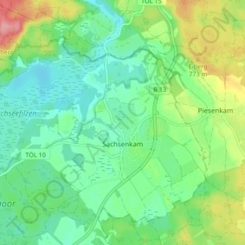
Name: Sachsenkam topographic map, elevation, terrain.
Average elevation: 2,385 ft
Minimum elevation: 2,267 ft
Maximum elevation: 2,648 ft
Other topographic maps
Click on a map to view its topography, its elevation and its terrain.
Gilgenhöfe
Germany > Bavaria > Landkreis Bad Tölz-Wolfratshausen > Lenggries
Average elevation: 2,497 ft
Wegscheid
Germany > Bavaria > Landkreis Bad Tölz-Wolfratshausen > Lenggries
Average elevation: 2,461 ft
Benediktenwand
Germany > Bavaria > Landkreis Bad Tölz-Wolfratshausen > Benediktbeuern
Average elevation: 4,472 ft